The Role of GPS in Aviation
GPS (Global Positioning System) plays a crucial role in aviation across various aspects of flight operations, navigation, and safety. Here's an overview of the key roles of GPS in aviation:
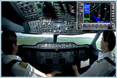
Navigation: GPS is widely used for aircraft navigation, providing accurate positioning information to pilots during all phases of flight, including:
Flight Planning: GPS technology is used for flight planning and route optimization, allowing pilots to calculate fuel-efficient routes, avoid restricted airspace, and plan alternative routes in case of weather deviations or airspace closures.
Search and Rescue: GPS aids search and rescue operations by providing accurate location information for distressed aircraft, emergency beacons, and downed pilots. GPS-equipped emergency locator transmitters (ELTs) transmit distress signals with precise coordinates to facilitate rapid response and rescue efforts.
Traffic Management: GPS data is used in air traffic management systems to track aircraft movements, manage airspace congestion, and ensure safe separation between aircraft. GPS-based surveillance technologies, such as ADS-B (Automatic Dependent Surveillance-Broadcast), enhance air traffic surveillance and situational awareness for air traffic controllers.
Terrain and Obstacle Avoidance: GPS-based terrain awareness and warning systems (TAWS) provide pilots with real-time alerts and visual displays of terrain, obstacles, and hazardous terrain proximity during flight, helping prevent controlled flight into terrain (CFIT) accidents.
Timing and Synchronization: GPS provides precise timing and synchronization signals for aviation communications, navigation, and surveillance systems. GPS-derived time signals ensure accurate coordination of air traffic control communications, radar systems, and navigation aids.
Flight Data Recording: GPS data is integrated into flight data recorders (black boxes) and cockpit voice recorders (CVRs) to capture accurate information about aircraft position, altitude, speed, and heading during flight. This data is crucial for accident investigation and flight data analysis.
Overall, GPS technology enhances the safety, efficiency, and reliability of aviation operations by providing accurate positioning, navigation, and timing capabilities to pilots, air traffic controllers, and aviation stakeholders. By integrating GPS data into aircraft systems and air traffic management infrastructure, aviation authorities can ensure safer and more efficient air travel for passengers and cargo worldwide.
Thank you,