The Civilian use of GPS
Civilian use of GPS (Global Positioning System) encompasses a wide range of applications across various sectors and industries. Here are some of the key civilian uses of GPS:
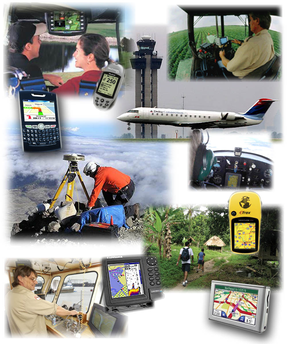
Vehicle Navigation: GPS is widely used in vehicle navigation systems for cars, trucks, motorcycles, and other vehicles. GPS receivers provide drivers with accurate positioning information, turn-by-turn directions, real-time traffic updates, and route optimization features.
Outdoor Recreation: GPS devices and smartphone apps are popular among outdoor enthusiasts for activities such as hiking, camping, backpacking, cycling, fishing, and geocaching. GPS receivers provide users with accurate positioning, route tracking, and waypoint navigation in remote or unfamiliar terrain.
Marine Navigation: GPS technology is utilized in marine navigation systems for boats, yachts, ships, and other watercraft. GPS receivers provide precise positioning, course plotting, and navigational aids, enhancing safety and efficiency for maritime operations.
Aviation: GPS is integrated into aircraft navigation systems for general aviation, commercial aviation, and air traffic control. GPS receivers provide pilots with accurate positioning, route guidance, approach procedures, and situational awareness during all phases of flight.
Smartphones and Mobile Devices: GPS functionality is built into many smartphones and mobile devices, allowing users to access location-based services, navigation apps, mapping tools, and location-based social media features. GPS enables applications such as ride-sharing, food delivery, fitness tracking, and augmented reality games.
Fitness and Sports: GPS devices and fitness trackers are used by athletes, runners, cyclists, and fitness enthusiasts to track workouts, monitor performance metrics, and analyze training data. GPS receivers provide accurate distance, speed, elevation, and route information for outdoor activities.
Geocaching: Geocaching is a recreational activity that involves using GPS coordinates to search for hidden containers (geocaches) outdoors. GPS devices and smartphone apps are used to navigate to geocache locations, find hidden treasures, and participate in a global treasure-hunting community.
Mapping and Surveying: GPS technology is employed in mapping, surveying, and GIS (Geographic Information System) applications for creating accurate maps, conducting land surveys, and collecting geospatial data. GPS receivers provide precise positioning information for cartography, urban planning, environmental monitoring, and resource management.
Emergency Services: GPS technology aids emergency services, including police, fire, and medical responders, in locating and navigating to incident locations more quickly and accurately. GPS-enabled devices transmit location data during emergencies, facilitating rapid response and rescue operations.
Precision Agriculture: GPS is utilized in precision agriculture for mapping fields, monitoring crop health, and optimizing farm operations. GPS-guided tractors, drones, and agricultural machinery enable variable rate applications of fertilizers, pesticides, and irrigation, leading to improved crop yields and resource efficiency.
These are just a few examples of the diverse civilian applications of GPS technology, highlighting its widespread use and importance in modern society.
Thank you,