GPS used in Navigation
GPS (Global Positioning System) is widely used in navigation across various domains, including land, sea, air, and space. Here's how GPS is used in navigation:
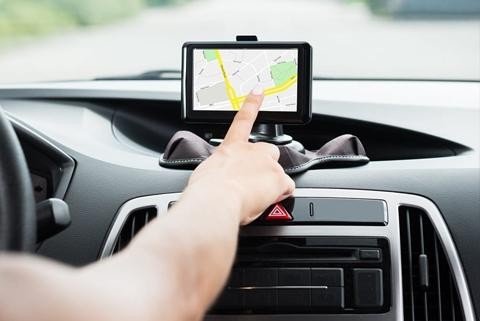
Vehicle Navigation: GPS is extensively used in vehicle navigation systems, such as those found in cars, trucks, buses, and motorcycles. GPS receivers in these vehicles determine the vehicle's current position and provide turn-by-turn directions to the desired destination. These systems calculate the shortest or fastest route based on real-time traffic conditions, speed limits, and user preferences.
Aviation Navigation: GPS plays a crucial role in aviation navigation, providing pilots with accurate position information, route guidance, and situational awareness. GPS receivers onboard aircraft enable precise navigation during all phases of flight, including takeoff, en route navigation, approach, and landing. GPS is especially valuable in navigating through airspace with complex routes and terrain, as well as during low-visibility conditions.
Maritime Navigation: GPS is widely used in maritime navigation for ships, boats, and other watercraft. GPS receivers onboard vessels determine the vessel's position, speed, and heading, allowing for precise navigation and route planning. GPS-based electronic charting systems display navigational charts and provide real-time updates on vessel position relative to navigational hazards, ports, and other vessels.
Outdoor Recreation: GPS devices and smartphone apps are popular among outdoor enthusiasts for activities such as hiking, camping, cycling, and geocaching. GPS receivers provide users with accurate positioning information, route tracking, and waypoint navigation in remote or unfamiliar terrain. Outdoor GPS devices often include features such as topographic maps, trail guides, and location-based alerts for safety and convenience.
Geospatial Surveying: GPS is extensively used in geospatial surveying, mapping, and GIS (Geographic Information System) applications. Surveyors and cartographers use GPS receivers to collect precise location data for mapping terrain, infrastructure, property boundaries, and natural features. GPS data is integrated with other geospatial data layers to create detailed maps, manage resources, and analyze spatial patterns.
Search and Rescue: GPS technology aids search and rescue operations by providing accurate location information for individuals in distress. Personal locator beacons (PLBs), emergency beacons, and GPS-enabled smartphones transmit distress signals with precise coordinates to search and rescue authorities, enabling rapid response and location of the individuals in need of assistance.
Overall, GPS technology revolutionizes navigation by providing accurate positioning, route guidance, and situational awareness across various domains, enhancing safety, efficiency, and convenience for users worldwide.
Thank you,